What the Survey Shows
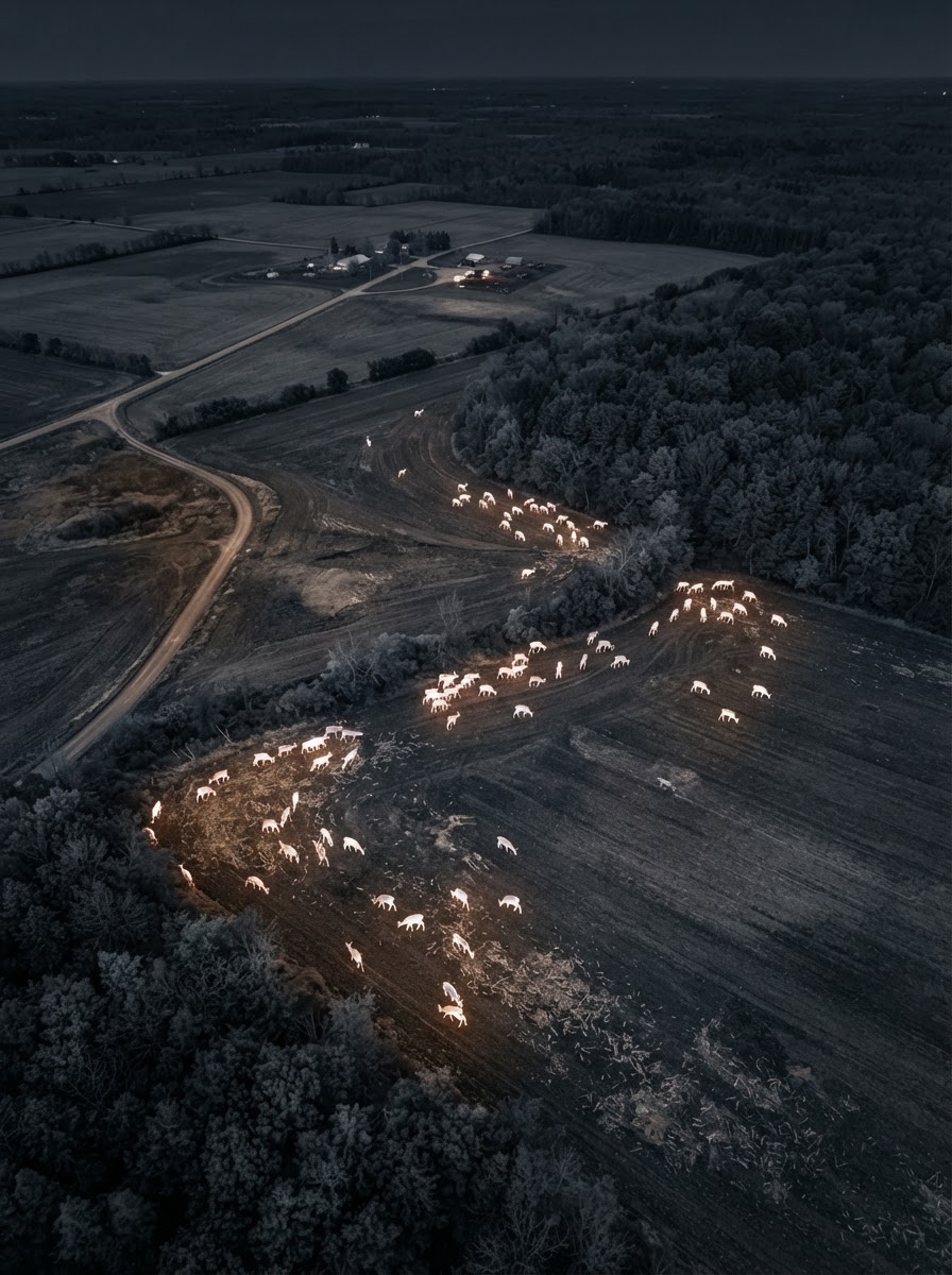
- Survey deer activity across large tracts of land from above
- Identify areas of concentrated movement and bedding
- Thermal imaging captures activity that's hard to observe on foot
- A practical tool for land management and planning
A Bird's-Eye View of Your Property
Managing land for deer means understanding how deer actually use it — where they move, where they bed, and where they gather. From the ground, that picture is hard to put together, especially on larger tracts.
Thermal aerial imaging lets a landowner see activity across the whole property at once. Heat signatures stand out against the cool ground, revealing movement and concentration that would otherwise go unnoticed.
It's a practical tool for landowners across Western Maryland and nearby West Virginia who want to make informed decisions about their property and the herd on it.
Surveying deer activity on your land? request a herd analysis or see our service areas. Need help locating a deer instead? Visit our deer recovery page.
Want to See Your Herd From Above?
Tell us about your property and what you'd like to learn. We'll help you understand the search area.